
Drone surveys
Detail down to about 1 cm per pixel: every plant, every gap in the row, on your own parcel.
Our team flies your parcel and shows you what a satellite cannot: every plant, the gaps in the row, the weak zones. You get the maps within 48–72 hours. Suited to small parcels, orchards and vineyards, or whenever you need the detail.
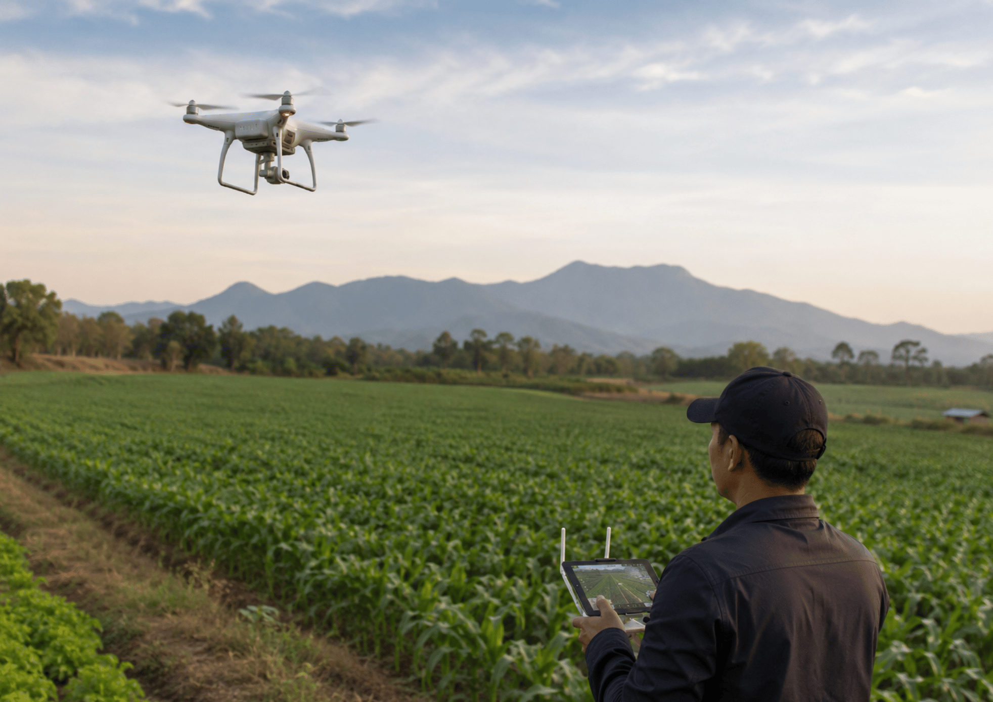
What a drone sees that a satellite cannot
Drag the handle across a vineyard. In true colour you see every row and every gap; the vigour map shows how the vines are growing, so you know where to walk first.
A vineyard seen by drone: on one side in true colour, on the other its vigour map
True colourVineyard vigour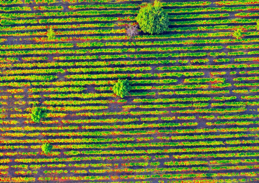
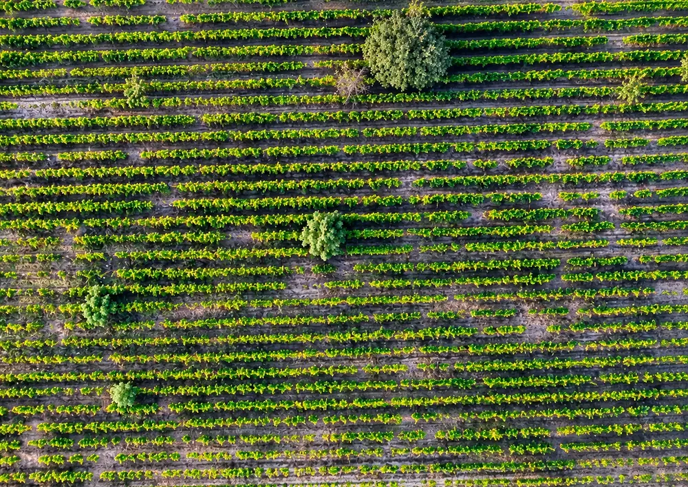
- True colour
- Every row, every gap
- See the missing vines and the gaps in the row; our analysts count the plants and mark the gaps on the map.
- Vineyard vigour
- Where the vines fall behind
- See which vines grow strongly and which fall behind, so you go straight to the rows that need attention.
- What you receive
- Your maps in 48–72 h
- The orthophoto, the vigour maps and the terrain model, as files that stay yours.
What you get
Everything you need to make field decisions based on data — not assumptions. Features included in this solution:
- / 01
See every plant: down to about 1 cm per pixel
- / 02
Count the plants and find the gaps in the row — maps made by our analysts
- / 03
Vigour maps from a multispectral camera, on the exact spot of the problem
- / 04
A precise, georeferenced orthophoto you can measure on
- / 05
The lie of the land: terrain model and slope map
- / 06
The files are yours to keep
How it works
How it works, step by step, from the first message to the result.
- 1
Request a quote
Send the field boundary (KML, GeoJSON or via the map), your preferred date and what you want to learn.
- 2
A reply within one business day
We check the weather window and flight authorization, then confirm price and date.
- 3
Our team flies the field
A 30-90 minute mission depending on area. We operate with an authorized pilot.
- 4
Files delivered in 48-72h
We process the flight and send you the orthomosaic, index maps and terrain model. Viewing drone layers inside the AGROGIS app is coming soon.
Technical details
For anyone who wants the exact numbers: sources, frequency, formats. For anything else, write to us.
- Resolution
- Down to ~1 cm per pixel
- Camera
- DJI Phantom 4 Multispectral (5 bands: R, G, B, RE, NIR)
- Coverage / flight
- 15-20 ha per battery, 40-55 ha in a session
- Delivered in
- 48-72h after the flight
- Authorization
- Licensed operator, full liability insurance
- Geographic coverage
- Romania (other countries on request)
Frequently asked
How much does a flight cost?
Around 8-16 EUR / hectare for standard flights, depending on area, distance and complexity. Ask for a custom quote.How many flights per season do you recommend?
For cereals: 2-3 (flowering, milky grain, pre-harvest). For orchards and vineyards: 3-4 (flowering, fruiting, pre- and post-harvest). For vegetables: monthly or on demand.Can I use my own drone?
Yes, if you have a compatible multispectral camera (DJI Phantom 4 Multispectral, MicaSense RedEdge / Altum, Parrot Sequoia). Send us the raw data: we process it and send the results back as files.What if the weather doesn't cooperate?
We reschedule at no extra cost. We don't fly if the wind exceeds 8 m/s or if it's raining.

Ready to start?
Try it on your own parcels, or tell us what you need — we reply within one business day.